
Garmin GPSMAP 79s
4.2Editor score
Floating rugged design
Worldwide basemap included
Up to 20 hours battery life
Finding the right marine GPS unit is essential for safe navigation on the water. Whether you are fishing, cruising, or racing, a reliable system provides critical data about your location, depth, and surroundings to keep your vessel on course.
We evaluated ten leading models based on display quality, mapping features, sonar integration, and connectivity options. Our analysis focuses on real-world performance, ease of use, and the specific strengths each unit offers to different types of boaters.
Each selection below highlights key capabilities and trade-offs to help you decide. Note that prices and availability change frequently, so always verify current listings before making your final purchase decision for your boat.
4.2Editor score

4.4Editor score

4.7Editor score
As an Amazon Associate we earn from qualifying purchases.
The following table provides a side-by-side overview of all ten models featured in this guide. Use this summary to quickly compare screen sizes, included sensors, and key connectivity options before diving into the detailed reviews.
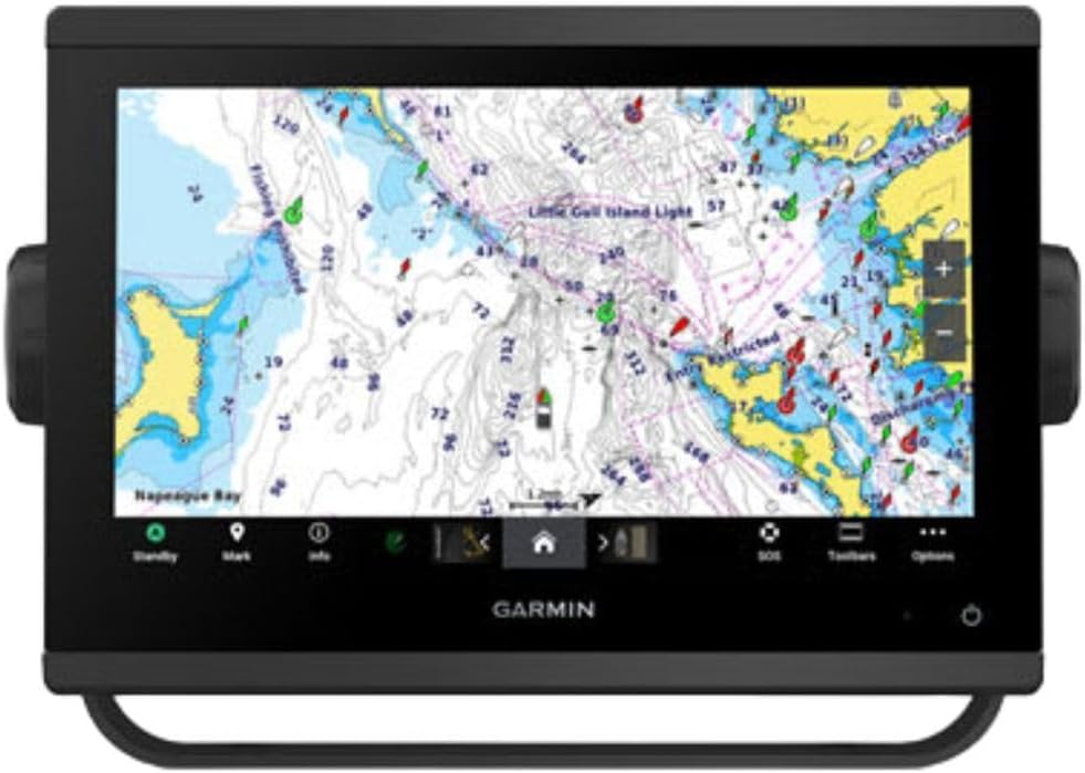


The Simrad GO Chartplotter stands out as a versatile solution for sportboats and smaller cruisers seeking reliable navigation and fish-finding capabilities. It receives high marks for its integrated GPS and ability to support various connectivity protocols.
We may earn a commission when you buy through this link, at no additional cost to you.
This unit ships with a C-MAP Discover card that provides detailed Vector Charts and bathymetric contours across the US and Canada. The included HDI transducer supports CHIRP sonar and DownScan Imaging to help identify bottom structure clearly.
While the display is excellent, users should note that full radar capability requires an additional purchase. The interface is robust but may require time to learn for those new to multifunction displays.
This model is ideal for boaters who need a balance of performance and value without sacrificing essential mapping data. It integrates seamlessly into larger NMEA 2000 systems for expanded control options.
Built-in Wi-Fi allows you to mirror the display to a smartphone or tablet for easy access to charts and radar data from anywhere on board.
The C-MAP high-resolution bathymetric contours provide precise depth shading to help you avoid hazards and locate promising fishing spots effectively.
We may earn a commission when you buy through this link, at no additional cost to you.
The ECHOMAP UHD2 94sv delivers a premium experience with its bright 9-inch touchscreen and advanced scanning sonar technology. It is designed for clarity and ease of use even in direct sunlight conditions.
We may earn a commission when you buy through this link, at no additional cost to you.
Included in the box is the GT56-TM transducer which supports traditional, ClearVü, and SideVü scanning sonars. This combination offers detailed views of fish and structure below the boat for better targeting.
While it supports Navionics+ coastal charts, users outside these regions may need to purchase additional maps. The price reflects the high-quality hardware and integrated features offered in this package.
This unit is perfect for anglers who want top-tier sonar views and the convenience of wireless updates. The ability to control a Force trolling motor wirelessly adds significant utility to the experience.
Wireless connections to compatible trolling motors allow you to navigate to waypoints and control speed directly from the chartplotter screen easily.
SideVü and ClearVü scanning provide detailed images of the water column and bottom structure to help you find fish quickly and accurately.
We may earn a commission when you buy through this link, at no additional cost to you.
The GPSMAP 943xsv is tailored for boaters who demand high-definition imaging for structure and fish identification. Its focus is on delivering ultra-high definition scanning sonar for precision targeting.
We may earn a commission when you buy through this link, at no additional cost to you.
This model supports Panoptix sonar systems which allow you to look down, forward, and sideways in real time. The improved display optics ensure that these complex images remain clear and readable at all times.
While mapping is pre-loaded, users will need to purchase compatible transducers separately to unlock the full scanning potential of the unit. This keeps the base price lower but adds to the total system cost.
Ideal for serious anglers, this unit offers superior visualization capabilities that help you understand underwater topography better than standard sonars. It is a specialized tool for maximizing time on the water.
Panoptix support allows you to see fish and structure in real time whether looking down, forward, or to the side of your vessel.
Ultra high-definition scanning provides crisp images of the lake or ocean bottom to help you identify fish targets more effectively.
We may earn a commission when you buy through this link, at no additional cost to you.
This model represents a full marine navigation solution with a massive 12-inch display and included radar dome. It is designed for boats that require extensive system integration and high-end performance.
We may earn a commission when you buy through this link, at no additional cost to you.
You can connect third-party devices via OneHelm digital switching to control various engine and vessel systems from the chartplotter. This capability makes it a central hub for modern marine electronics.
The high price point reflects the comprehensive nature of this unit which includes radar and superior network connectivity features. It is best suited for larger vessels with complex navigation needs.
If you need a centralized control interface for your boat, this chartplotter offers the connectivity and display quality to manage everything from one screen. It ensures superior situational awareness for safety.
OneHelm digital switching allows you to build your marine system with superior network connectivity for controlling various onboard systems.
You can control your marine experience remotely through the network which adds convenience for captains managing the vessel from different spots.
We may earn a commission when you buy through this link, at no additional cost to you.
The GPSMAP 79sc is a robust handheld option designed for those who need portable navigation. It features preloaded BlueChart g3 coastal charts to help you stay oriented near shorelines.
We may earn a commission when you buy through this link, at no additional cost to you.
Its rugged design meets IPX6 water resistance standards and includes a floating feature to prevent loss if dropped. This makes it a safe backup for small boats or kayaks.
While the screen is small compared to fixed chartplotters, the device includes a barometric altimeter and compass for enhanced situational awareness. Battery life extends up to 20 hours in GPS mode.
This is the perfect emergency device for anyone needing reliable tracking without a fixed system. It provides essential data in a package that fits in a pocket or life vest.
The included BlueChart g3 charts provide detailed coverage of coastal areas to help you navigate safely near shore and harbors.
Rugged construction with floating capability ensures the unit stays safe and usable even in rough water conditions or accidental drops.
We may earn a commission when you buy through this link, at no additional cost to you.
The GPSMAP 79s offers global utility with a worldwide basemap included. It is built for travelers who want portable navigation without needing specific regional map purchases.
We may earn a commission when you buy through this link, at no additional cost to you.
Like the 79sc it is rugged water-resistant and designed to float. This ensures reliability in wet environments and provides peace of mind for kayakers and sailors.
Battery life is rated up to 20 hours in GPS mode which is excellent for long day trips or overnight expeditions. The screen is high-resolution but compact for portability.
This model is an ideal choice for international travel or casual cruising where detailed charts are not the primary concern. It delivers consistent tracking in a durable form factor.
Worldwide basemap coverage means you can track your position anywhere in the world without needing to buy additional map regions.
Rugged water resistant build and floating capability make this unit safe to use in wet environments without fear of damage or loss.
We may earn a commission when you buy through this link, at no additional cost to you.
The GPSMAP1022XSV offers a spacious 10-inch display in a compact combo housing. It provides clear visibility for charts and navigation data even in bright sunlight.
We may earn a commission when you buy through this link, at no additional cost to you.
This model ships with a basemap but does not include a transducer. This means users must purchase sonar hardware separately to utilize fish-finding features.
The large screen makes it easy to view multiple data points at once without clutter. It is suitable for boats that already have sonar systems or prefer a visual-only approach.
This unit is best for boaters prioritizing display size and interface ease over bundled sensors. It provides a solid foundation for building a customized marine electronics setup.
The 10-inch screen offers ample space to view charts and data clearly without making the unit too large for smaller consoles.
Because no transducer is included you can choose the exact sonar type that matches your specific fishing and navigation requirements.
We may earn a commission when you buy through this link, at no additional cost to you.
The GPS 76 is a straightforward handheld device focused on accurate tracking. It is designed for users who need basic location data without complex chart features.
We may earn a commission when you buy through this link, at no additional cost to you.
This unit supports WAAS for continuous satellite tracking and holds up to 12 satellites for improved signal accuracy. It includes a trip computer with current and average speed data.
While the display is not advanced it offers reliable performance for navigation. It relies on memory cards for map storage so you must manage those separately.
This is a reliable tool for hikers or boaters needing simple point-to-point navigation. It offers excellent battery life and simplicity for those who prefer a no-frills approach.
WAAS enabled support ensures continuous tracking and use of up to 12 satellites for reliable position updates in open areas.
The built-in trip computer tracks current and average speed as well as trip distance to help you manage your journey time.
We may earn a commission when you buy through this link, at no additional cost to you.
The GPSMAP 1223xsv features a bright 12-inch IPS panel that is easy to read in all conditions. It is built for those who want detailed traditional and scanning sonar.
We may earn a commission when you buy through this link, at no additional cost to you.
It includes built-in CHIRP ClearVü and SideVü scanning sonars to provide detailed views of fish and structure below the boat. The worldwide basemap covers most global water bodies.
Connectivity is robust with NMEA 2000 networking allowing connection to engines VHF radios and digital switching systems. The 5000-watt sonar ensures excellent target separation even in deep water.
This model is ideal for serious anglers needing clarity and connectivity on larger boats. It provides high-resolution visuals and networking to keep you informed about your environment.
The 12-inch IPS touchscreen is bright clear and easy to read in direct sunlight for clear visibility at all times.
5000-watt traditional CHIRP sonar provides excellent target separation and clarity even in deep water to help you find fish.
We may earn a commission when you buy through this link, at no additional cost to you.
The GPSMAP 743 is a compact unit designed for boaters who need detailed mapping in a smaller package. It ships with Navionics+ mapping for enhanced chart detail.
We may earn a commission when you buy through this link, at no additional cost to you.
This non-sonar model supports Panoptix sonar systems separately so you can add imaging later. The improved display optics ensure clarity in varying lighting conditions.
While it lacks built-in sonar it remains powerful for navigation thanks to the detailed mapping software. It is suited for smaller boats with limited console space.
This is a strong choice for captains prioritizing chart detail and display clarity over bundled sensors. It allows for future expansion if you later decide to add fish-finding gear.
The included Navionics+ mapping offers detailed coastal data to help you navigate with precision in complex waters.
Support for Panoptix sonar allows you to add advanced imaging capabilities later if you choose to upgrade your system.
We may earn a commission when you buy through this link, at no additional cost to you.
Selecting the right marine GPS involves balancing display size, chart details, and connectivity. Consider these factors to match the unit to your specific vessel and needs.
Larger screens offer better visibility and easier touch control but require more console space. Look for sunlight-readable displays with high resolution to ensure you can read data in bright conditions.
Choose a size that fits your dashboard and viewing distance while ensuring the interface is readable from anywhere in the boat.
Different units come with various chart types such as coastal regional or worldwide basemaps. Ensure the included maps match your primary cruising area to avoid extra purchase costs.
Verify if the chart provider offers updates and detailed bathymetric contours for safe navigation in shallow or unfamiliar waters.
Decide if you need built-in sonar or a separate transducer. Combo units simplify installation while standalone units allow for flexible sonar hardware choices.
Consider the sonar frequency and scanning features like SideVü to understand the depth and clarity you need for your specific fishing style.
Modern units often support NMEA 2000 Wi-Fi and Bluetooth for system integration. This allows connection to engines VHF radios and other marine electronics.
Check for wireless capabilities to update maps or mirror screens to your smartphone for easy access to navigation data.
Fixed units require a permanent power connection while handhelds rely on batteries. Ensure the unit you choose meets your power requirements for long trips.
Look for battery ratings around 20 hours for handhelds to ensure you do not lose tracking during extended journeys.
Marine environments are harsh so look for waterproof ratings like IPX6 to prevent water damage. Rugged designs with scratch-resistant glass improve longevity.
Ensure the mounting hardware is robust and easy to install for a secure fit on your vessel.
The interface should be intuitive enough to learn quickly without sacrificing power. Touchscreens are common but physical buttons offer better control in rough seas.
Test the layout in a demo if possible to ensure it fits your workflow while navigating and managing charts.
If you already own marine electronics ensure the new unit works with your existing network. OneHelm switching and third-party support are valuable for expanding systems.
Check compatibility with existing radars or trolling motors to avoid unnecessary replacement costs.
Install the unit securely on a stable surface and ensure the antenna has a clear view of the sky for accurate tracking. Connect power cables to the appropriate marine fuse box to prevent electrical issues.
Update the charts and software regularly using the Wi-Fi connection to keep your navigation data current. Review the menu settings to customize alerts for depth or waypoints based on your trip needs.
Clean the display with a soft damp cloth to avoid scratching the screen. Store handheld models in a dry case when not in use to protect them from salt and moisture damage.
Most units include a one-time map card or preloaded maps. However some manufacturers like Navionics offer optional online subscriptions for regular updates or additional data layers.
Yes handhelds serve as excellent backups on large vessels. They are rugged waterproof and provide reliable tracking if your main fixed chartplotter fails during navigation.
CHIRP sonar sends multiple frequencies over a wide range to produce detailed images of fish and structure. Standard sonar uses a single pulse which may appear less defined on the display.
Yes these units rely on satellite signals rather than cellular data. Once loaded with maps you can navigate offline without needing an internet connection.
Look for an IPX6 waterproof rating which ensures resistance against powerful water jets. Always rinse the unit with fresh water after exposure to saltwater to prevent corrosion.
Many modern units allow you to share sonar data waypoints and routes wirelessly. Check if your devices support this feature to update your boat network without physical cables.
We reviewed ten top marine GPS units ranging from compact handhelds to large chartplotters. Our top picks offer the best balance of features and value for most boating scenarios.
Prioritize your needs by considering display size chart detail and required connectivity. Matching the unit to your specific vessel ensures you get the best performance from your investment.
Always verify current pricing and availability before purchasing. Prices fluctuate and models may be updated so checking the latest listings guarantees the best value for your budget.